
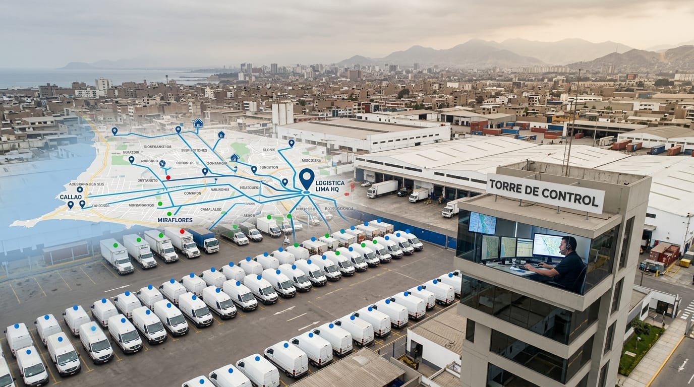
A fleet GPS tracker is a device installed in each vehicle that sends its location, speed, engine data and alerts over the cellular network to a web platform and a mobile app. To choose one in Peru, look at how often it reports, coverage on your routes, the features you need, and who installs and supports it locally.
This guide walks through each criterion using a real example: Ituran GPS, which Endeavant represents in Peru. If you already know the system you want and need the manufacturer detail, read our article on Ituran GPS and fleet telematics.
What is fleet GPS tracking and how does it work?
Fleet GPS tracking has three parts: the device in the vehicle, the network that carries the data, and the platform where you see it. The device works out its position from satellites and sends it over the cellular network along with speed, engine data and alerts. With Ituran GPS, the technician installs the unit under the dashboard, wired to the electrical system and the OBD / CAN Bus port, and it reports every 10 seconds over 4G.
On the other end, the web platform and app show the live map, trip history, geofences, reports and driver ranking. With that data you manage fuel, schedules, speed and maintenance for every unit.
What should you look for in a fleet GPS system in Peru?
The criteria that matter most are reporting frequency, coverage on your routes, the platform, local technical support, scalability and data ownership. Hardware matters, but a fleet is run from the platform and the system is only as good as its support.
- Reporting frequency: how many seconds between position updates. With sparse reports, trips look jumpy, mileage loses accuracy and small geofences miss events. Ituran GPS reports every 10 seconds.
- Coverage on your routes: ask how the device behaves on the stretches of your routes with no cellular signal, and how that data is recovered once the unit is back in coverage.
- Platform and app: stability, automatic reports, alerts you can configure by event type and mobile access. Check which reports come out of the box and what you can set up yourself.
- Local technical support: who installs, how fast, and who answers when a unit stops reporting. A provider with no technicians in the country makes every fix slower.
- Scalability: adding 10 or 100 units should not force you onto a new platform. The Ituran platform scales from a single vehicle to fleets of thousands.
- Data ownership: make sure your fleet data belongs to you and that you can export the history whenever you need it.
Satellite or cellular GPS tracking: what is the difference?
Almost every fleet tracker is both: position is calculated from satellites and the data travels over the cellular network. Location works anywhere in Peru with a clear sky; what depends on coverage is real-time transmission. So the useful question is what happens to the data when the unit loses signal.
Trackers with satellite transmission cover areas with no cellular signal at all, and usually carry a higher service cost. For most urban and intercity fleets, 4G is enough; on remote routes, check each stretch against OSIPTEL's coverage map.
| Cellular-transmission tracking | Satellite-transmission tracking | |
|---|---|---|
| Position | GPS satellites | GPS satellites |
| Data link | Cellular network (4G) | Communication satellites |
| Where it transmits | Where there is cellular signal | Also where there is none |
| Typical use | Distribution, intercity freight, staff transport | Remote routes with no coverage |
How does vehicle tracking work on the coast, in the Andes and in the jungle?
Positioning works nationwide because it relies on satellites. What changes from region to region is cellular coverage, and with it how long the data takes to reach the platform:
- Lima and major cities: broad 4G coverage from Movistar, Claro, Entel and Bitel. Real-time transmission is continuous; the challenge is accuracy among tall buildings.
- Intercity highways: the Pan-American Highway and the Carretera Central have stretches with patchy coverage. Check with your provider how those stretches show up in the trip history.
- Andes and mine sites: cellular signal is concentrated in towns and camps. Position is still calculated; transmission may wait until the unit reaches coverage.
- Jungle: the toughest region: coverage limited to cities and dense vegetation that makes reception harder. Here, more than anywhere, validate the route before you decide.
Which features should a vehicle tracking system have?
A professional vehicle tracking system goes well beyond the map. These are the features that deliver operational value, as covered by the Ituran service:
- Real-time alerts: speeding, geofence exit, after-hours use and harsh braking, to your phone or email.
- Driver scoring: a 0 to 100 score per driver, based on 20 maneuver types detected by accelerometer (braking, acceleration, speed and cornering), with a daily leaderboard and a 7-day trend.
- Engine telematics: speed, RPM and temperature read via OBD / CAN Bus.
- Preventive maintenance: by mileage, time or engine hours, with a service history.
- Automatic reports: usage, mileage and hours for every unit, with no spreadsheets to consolidate.
- Remote immobilization: to stop the vehicle in case of theft.
- Trailers and cold chain: location of trailers that switch tractors, and temperature monitoring with out-of-range alerts.
What GPS cannot see is the driver's condition. For fatigue, distraction and collision risk, fleets add Endeavant DMS and ADAS cameras, which alert the driver in the cab while the Endeavant 24/7 Control Center validates every event. More in DMS and ADAS smart cameras.
How do geofences help you control a fleet?
A geofence is a virtual zone drawn on the map that alerts you automatically when a unit enters or leaves it. With Ituran GPS, geofences can be circular or polygonal with no limit on how many, with instant entry and exit alerts, restricted-zone notifications, after-hours use control, time spent per zone and vehicle, and speed alerts by zone, schedule and route.
In practice they are used to confirm deliveries, make sure a unit stays on its authorized route, catch unplanned stops and measure how long each vehicle spends at the plant, at the customer or at the fuel station.
How does GPS fuel monitoring work?
Fuel monitoring matches each unit's consumption against its route: if the level drops with no mileage to explain it, the system flags abnormal consumption or a drain. The Ituran service includes consumption monitoring, drain detection and abnormal-use alerts. The most common theft methods and how to spot them are covered in our guide to fleet fuel theft detection.
Can you track the fleet from your phone?
Yes. The Ituran Fleet app for iOS and Android shows each vehicle's status (moving, stopped or idle), trip playback with distance, duration, fuel and top speed, and push notifications for critical alerts. The web platform handles reports, geofence setup and fleet-wide analysis.
How much does fleet GPS tracking cost in Peru?
Fleet GPS has two cost components: the device installed in each unit and a monthly service that covers platform access, cellular data and technical support. That is how the Ituran service with Endeavant works. What drives the final figure:
- Number of units: the same service scales from one unit to thousands.
- Features you switch on: a distribution fleet does not measure the same things as a refrigerated fleet or one with trailers that change tractors.
- Vehicle type and installation: engine reading via OBD / CAN Bus, extra sensors and where each device goes.
- Rollout and support: installation, platform setup, training, and an equipment and labor warranty.
Compare proposals with the same scope. A low price with no professional installation, no local support or data you cannot export ends up costing more. For a tailored proposal, tell us how many units you run and what you want to measure.
What is Ituran and who represents it in Peru?
Ituran Location and Control Ltd. is an Israeli vehicle telematics company founded in 1995 and listed on NASDAQ (ITRN), with more than 2.6 million connected vehicles in over 26 countries and 43 million kilometers analyzed every day. Endeavant S.A.C. is its official representative in Peru: it installs the devices, sets up the platform, trains your team and provides technical support.
- Installed in under 45 minutes: per vehicle, at the Endeavant × Ituran authorized workshop.
- Full rollout: installation, platform setup and team training.
- Warranty: equipment and labor.
- Local technical support: by Endeavant technicians in Peru.
What does GPS tracking deliver for fleet operations?
A well-implemented GPS system pays off in several areas at once:
- Fuel: idling, speeding and drains become visible, with data to act on by unit and by driver.
- Theft: route deviations, unauthorized stops and remote immobilization let you act before cargo or vehicle theft is completed.
- Accidents: driver scoring and speed alerts point training at the drivers who need it.
- Maintenance: scheduled on actual mileage and engine hours, not estimates.
- Customer service: arrival estimates and claims settled with the trip history.
How do you choose the right GPS provider in Peru?
Beyond the technology, these questions separate a serious provider from the rest:
- Does it have its own technicians? a badly connected cable or a poorly placed device produces bad data that undermines the whole investment. Check who installs and how they are trained.
- What response times does it commit to? in a distribution fleet, a tracker offline for a full day means untracked deliveries and unresolved claims.
- Is the data yours? some providers hold on to trip history to lock customers in. Your information should be exportable.
- Does it serve your sector? ask for references with your type of operation: a delivery fleet does not have the same needs as a tanker fleet or staff transport.
Endeavant installs and supports Ituran GPS with its own technicians, and adds Endeavant smart cameras, the Endeavant Cloud platform and the 24/7 Control Center on the same fleet, with one installation and support team in Peru.
Where should you start with GPS for your fleet?
Start by defining what you want to control: location, fuel, driving behavior, schedules or maintenance. Then check real coverage on your routes and pick a provider with technical support in the country. Fleet GPS is a decision that stays with the operation for years: a reliable device, a stable platform and support that answers are worth more than the cheapest tracker.